
The easiest way to manage and edit point clouds
Work smarter with connected tools
01
Work anywhere, anytime
Access your point cloud data from any device with an internet connection. No specialized hardware or expensive workstations required. Just log in and continue your work seamlessly whether you're in the office, on site, or working remotely.
02
Unify your data sources
Say goodbye to scanner compatibility issues. ScanPlan accepts point cloud data from any scanner type, bringing all your important measurements into one central platform regardless of hardware origin.
03
Accelerate with AI
Our custom-trained AI model automatically identifies and classifies objects across 26 categories, significantly reducing manual labeling time. Focus on design decisions, not data preparation.
04
Collaborate without barriers
Share projects instantly with stakeholders through our secure cloud platform. Team members, clients, and contractors can all access the same source of truth, streamlining communication and preventing costly misunderstandings.
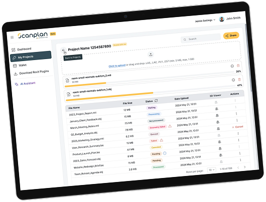
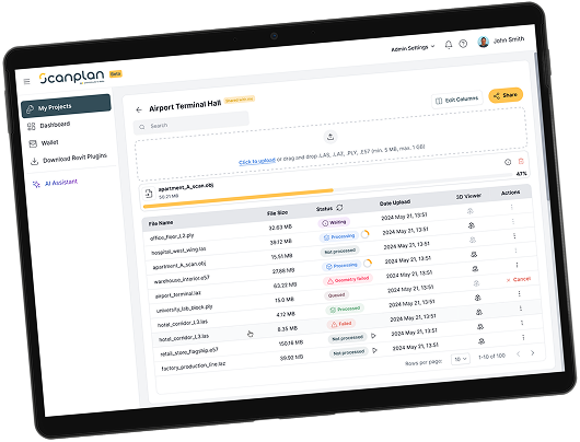
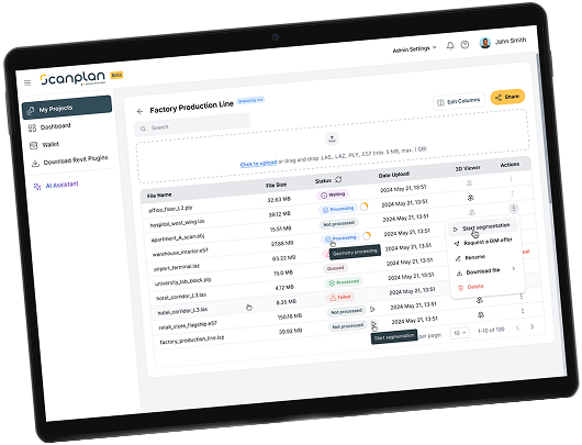
In 3 easy steps from scan to labeled point cloud
This is how the ScanPlan Portal works
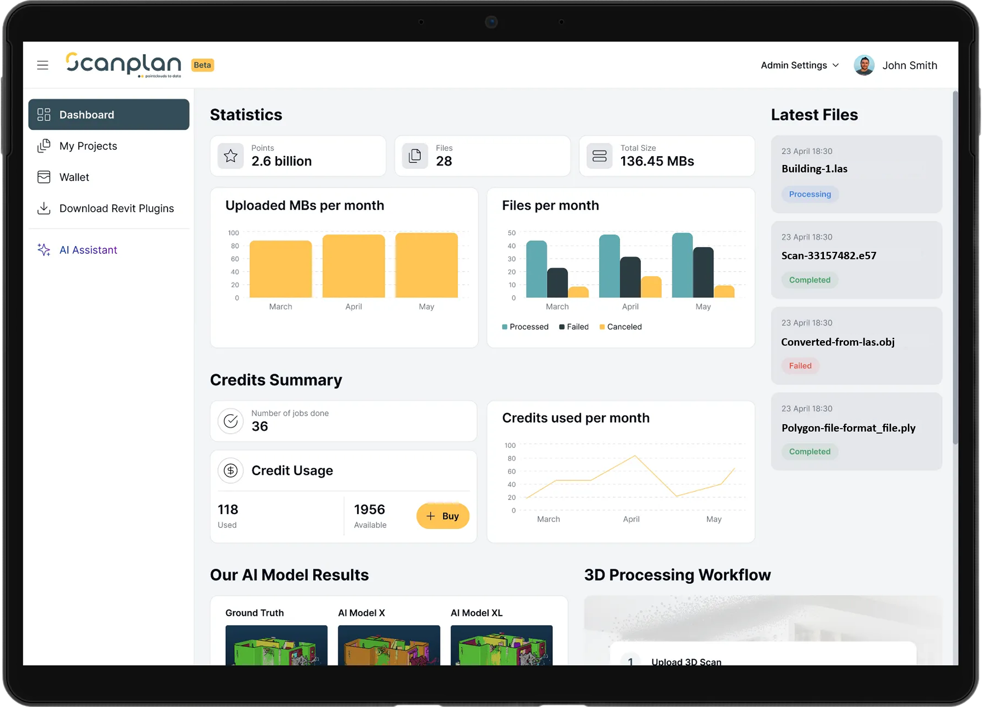
Dashboard
In your dashboard you can easily see:
- The number of MBs uploaded per month.
- Total number of files uploaded per month.
- Number of projects processed and credit usage.
- Recently uploaded files.
My Projects
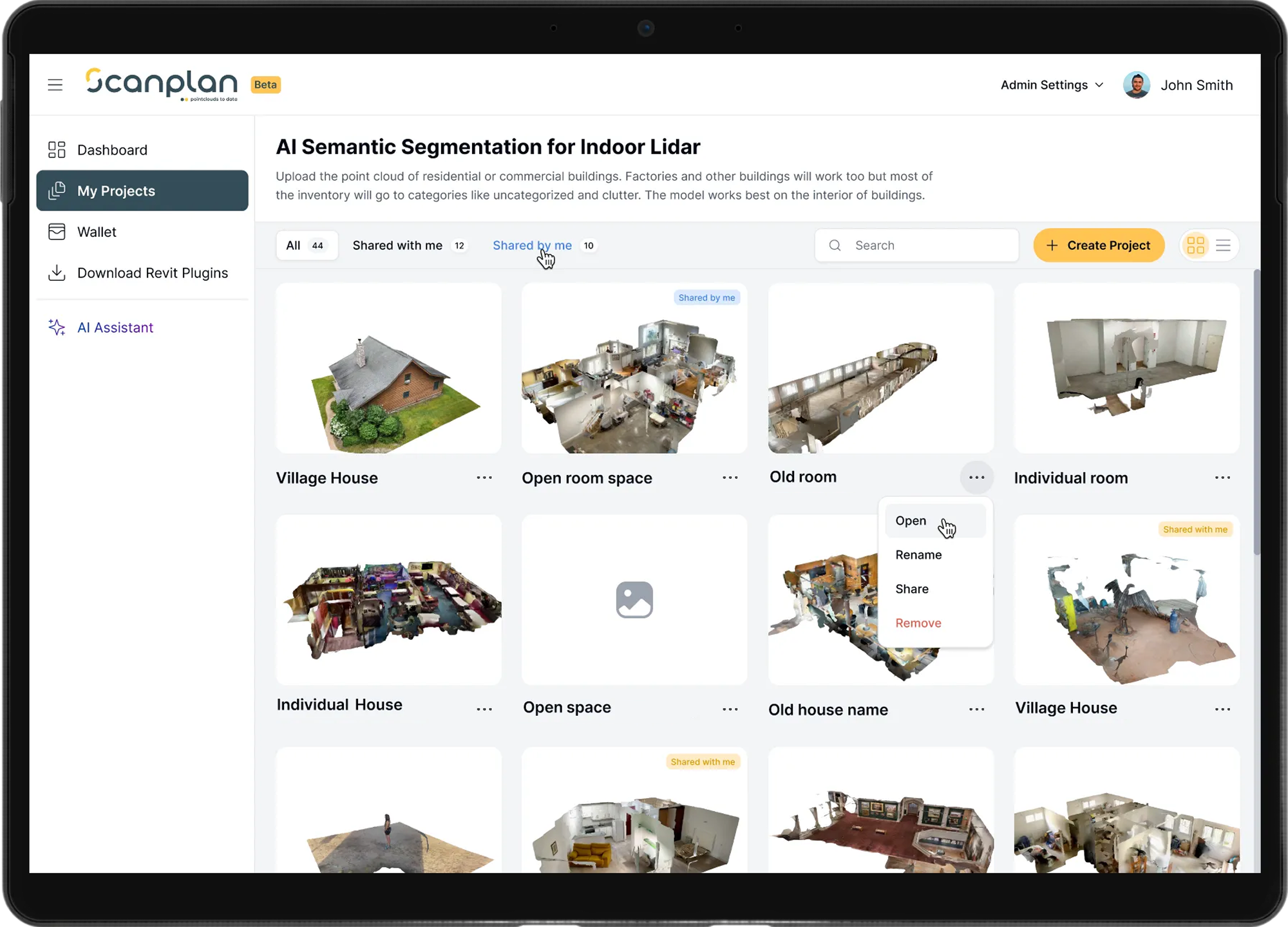
My Projects contains an overview of all your projects. Click on a project to get started.
You can see the processing status, download processed files, share them with stakeholders and view and edit them directly in the online viewer.
What makes ScanPlan smart
ScanPlan transforms spatial data into actionable insight by combining intelligent classification,
building structure detection, and smart data management.
SMART CLASSIFICATION
AI-Powered intelligence
Our custom-trained AI model automatically identifies and labels 26 different object categories in your point cloud, substantially reducing manual classification effort.
INTELLIGENT OPTIMISATION
Smart data management
Our advanced subsampling technology can automatically reduce point density in areas with surplus data while preserving critical details, maintaining quality while improving performance.
SEAMLESS INTEGRATION
From Scan to BIM in one workflow
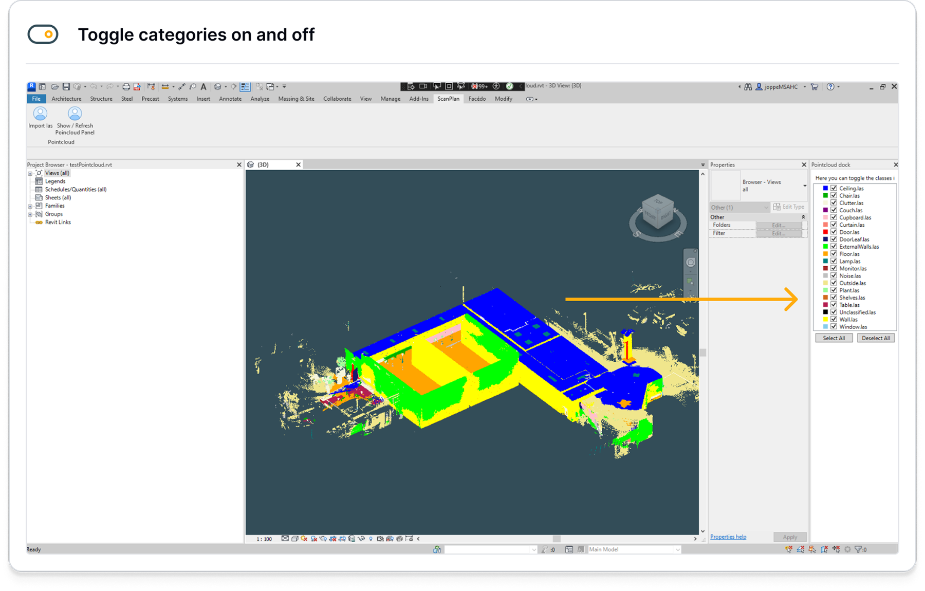
Connect point cloud data directly to your BIM process with our specialized Revit-plugin. Import classified point clouds and toggle visibility of specific elements for precise modeling.
Coming soon: Enhanced integrations with additional BIM platforms.
MULTI-FORMAT EXPORT
Flexible deliverables
Export your work in multiple formats including PDF, JPG, and DXF for sections and plans. Seamlessly integrate with existing workflows and software.
Coming soon: Additional export formats and customization options.
Do more with your point cloud
with the ScanPlan Revit plugin
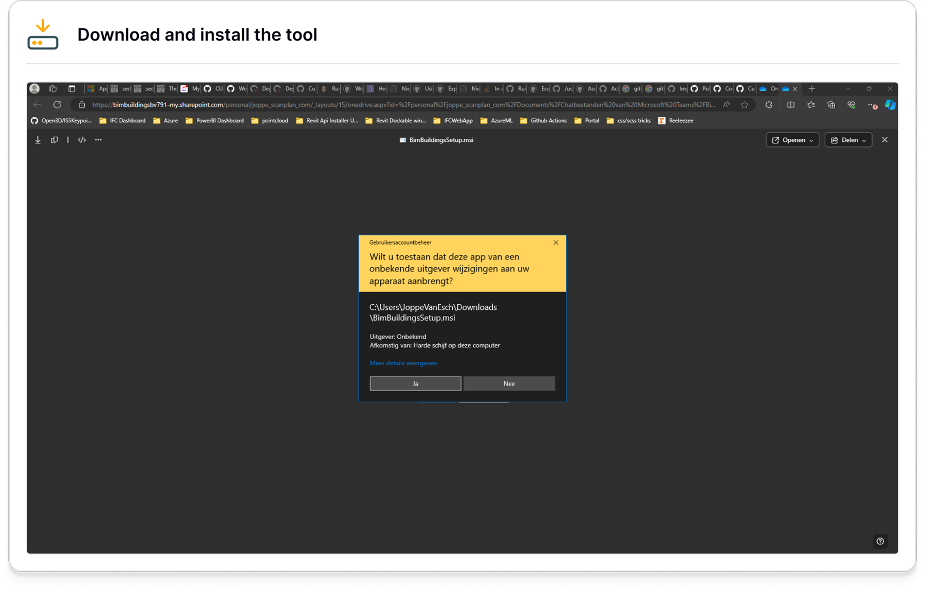
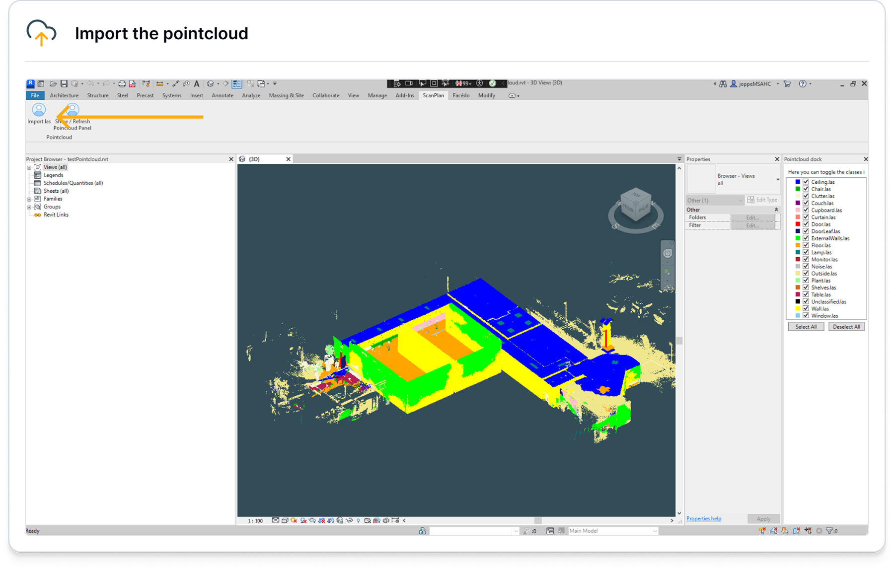
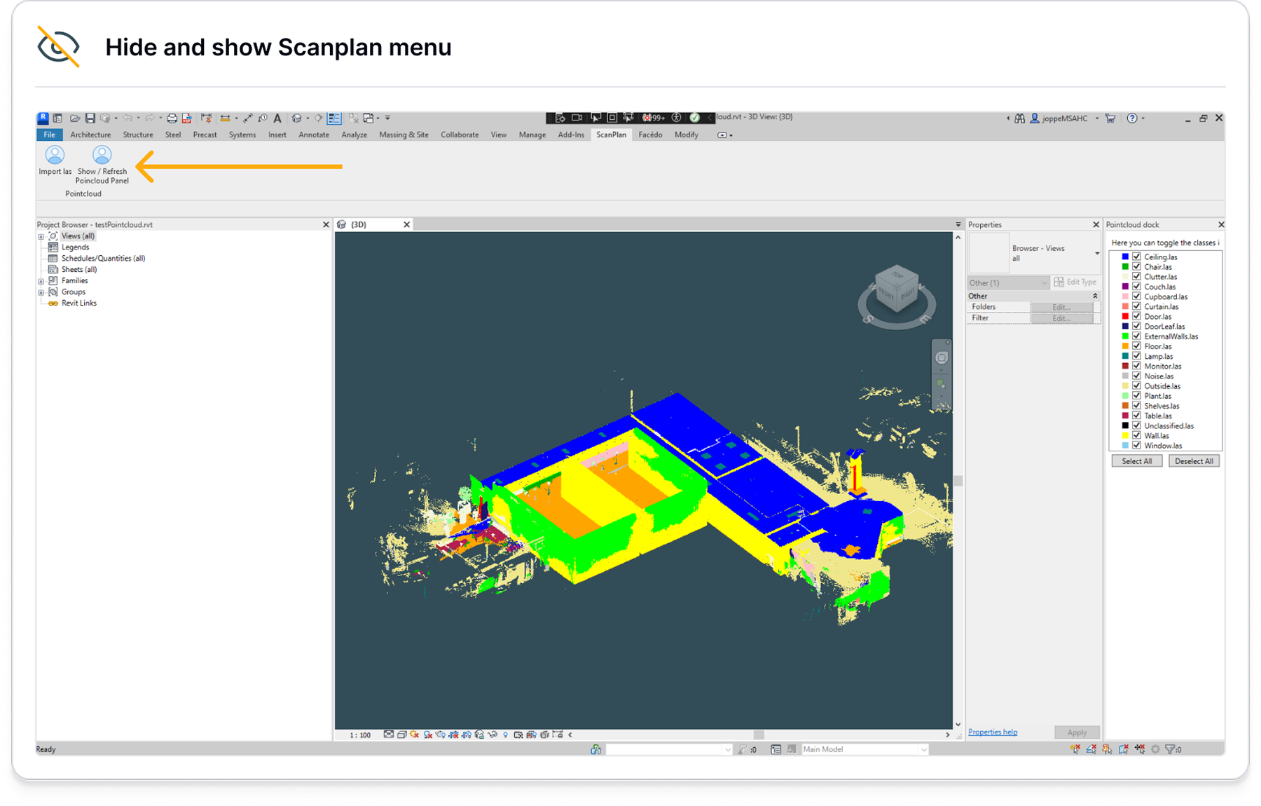
With our Revit plugin you import the classified point cloud and you can also easily show or hide parts in Revit. Logged in users can download the plugin for free from their dashboard.
The future of point cloud management
ScanPlan is constantly evolving to meet the needs of modern AEC professionals. Our development roadmap includes several exciting developments:
Coming soon
Advanced object recognition with expanding classification categories
Deeper BIM integrations across multiple platforms
AI-assistant to help you make the most of ScanPlan’s powerful capabilities
Generate easily viewable scenes to share with stakeholders
API for SAAS connections for automated processing workflows
Custom AI integrations and rich 3D models from point clouds
Frequently Asked Questions
-
ScanPlan is scanner-agnostic and can process point cloud data from any source, including terrestrial laser scanners, mobile mapping systems, and photogrammetry.
-
No. As a cloud-based solution, ScanPlan runs in your web browser on standard computers and laptops. No specialized graphics cards or processing power required.
-
Our self-trained AI identifies objects across 26 categories based on geometric patterns and spatial relationships. The system continuously improves with usage.
-
Yes. You can invite external stakeholders to view specific projects with a free Viewer plan, with no software installation required.
-
Our specialized Revit plugin allows you to import classified point clouds directly into your Revit environment, with the ability to show/hide specific categories.
-
Absolutely. ScanPlan employs enterprise-grade encryption and security protocols to ensure your data remains private and protected.
Years of experience in BIM and 3D.
In one tool to work faster and smarter
Point clouds? 3D scan? BIM?
What can I do with it?
Point Cloud
With our web app you can manage point clouds in a practical way. The app processes millions of 3D measurement points including X, Y, Z coordinates, color and intensity data. Then you can, for example, automatically segment and classify point clouds, which simplifies the preparation for further 3D analysis and modeling.
3D Scan
Our tool processes 3D scan data into useful information while maintaining millimeter precision. The platform accepts scan data from various sources and structures it for use in a digital twin. The ScanPlan app gives you the ability to efficiently segment and export scan data.
BIM (Building Information Model)
The ScanPlan app connects point cloud data with BIM workflows. Enrich BIM models with real-world data. It shortens the process from scan data to BIM components (scan-to-bim), making digital twins more accurate and 3D assets more usable throughout their lifecycle.